|
|
|
|
|
|
||||||||||
|
|
Geography
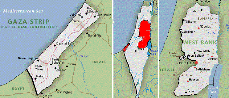
The total area of Palestine land is 26,323 km2. West Bank and Gaza Strip are little over 6,000 km2: 5,690km2 (2,263 sq mi) for the West Bank and 365km2 (139 sq mi) for the Gaza Strip. Gaza Strip has a 40-km (25-mi) coastline, an 11-km (7-mi) boundary with Egypt, and a 51-km (32-mi) boundary with Israel; its width varies between 6 and 14 km (3.7 and 9 mi). The Gaza Strip is largely flat and sandy, with dunes pushing in from the coast, particularly in the south. West Bank, territory in the Middle East on the western bank of the River Jordan, bracketed to the north, west, and south by Israel, and to the east by Jordan. It borders a portion of the Dead Sea to the south-east and rises along the western face of the Syrian-African Rift Valley. The highest point in Palestine is the Mount Meron: 1,208 m (3,963 ft) above sea level. The lowest point is the Shore of the Dead Sea 395 m (1,296 ft) below sea level.
The climate of Palestine is generally of the Mediterranean subtropical type, with rainfall generally limited to the winter months. In spite of their limited area, Gaza Strip and West Bank have the most exceptional climate and topographical structure in Palestine. The following table shows some climate information in Jerusalem:
The plant life of Palestine is different in three distinct regions: the Mediterranean coast, the Asian steppe, and the desert regions of the Arabian Peninsula. The country has about 2,500 species of plants, most of them xerophytic-that is, able to survive prolonged dry spells. Economically valuable products include citrus fruits, bananas, cotton, tobacco, grapes, dates, figs, olives, plums, and almonds. Dwarf oak and various other deciduous and coniferous trees have increased in number in recent years. Many of the Plants, like the olive, vines and oak trees, are indigenous, but some were brought by the different peoples who ruled Palestine through the ages.
|